Development Opportunity for
1029 Geary St, San Francisco, CA
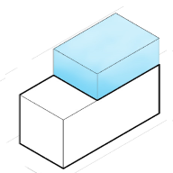
192% Potential
($51,908,053 Untapped Value)
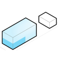
This property is a Other currently used as a Multi-Family Residential. Property is on a lot of 9,239 sqft and has a conditioned area of 38,184 sqft.
Development Options for
1029 Geary St, San Francisco, CA
What are the local zoning regulations for 1029 Geary St ?
NCD-LOWER POLK STREET (LOWER POLK STREET NEIGHBORHOOD COMMERCIAL DISTRICT)
The Lower Polk Street Neighborhood Commercial District is located along Polk Street and includes non-contiguous parcels from Geary Street to Golden Gate Avenue with frontage on Geary Street, Golden Gate Avenue, and other side streets. The District is located along a heavily trafficked thoroughfare which also serves as a major transit route. In addition to providing convenience goods and services to the surrounding neighborhood, the District offers a wide variety of comparison and specialty goods and services to a population greater than the immediate neighborhood.
The Lower Polk Street Neighborhood Commercial District, spanning from Geary Street to Golden Gate Avenue, is a vibrant area situated along a major transit route. Offering both convenience goods to the neighborhood and a diverse array of comparison and specialty goods to a broader population, the district encourages a varied commercial environment. Building standards allow moderately large commercial uses and buildings, with protected rear yards at residential levels. The district supports housing development above the second story, safeguarding existing residential units against demolitions and upper-story conversions. Accessory Dwelling Units are permitted within the district, contributing to its dynamic character.
Permitted Residential Uses: ADU, intermediate length occupancy, single room occupancy, student housing, residential uses, dwelling units, senior housing, and group housing and homeless shelters.
Permitted Non-Residential Uses: Walk-up facility agriculture (neighborhood), arts activities, general and nighttime entertainment, Community Facility, Job Training, Public Facilities, Social Service or Philanthropic Facility, Animal Hospital, Bar, Massage Establishment, Massage (Foot/Chair), Restaurant, Limited Restaurant, General Retail Sales and Service, Financial Services Fringe Financial Services Limited, Financial Services, Retail Professional Services, and Trade Shop.
What is the maximum height for 1029 Geary St ?
130-E
How to measure height in San Francisco?
A point shall be taken at the centerline of the building or, where the building steps laterally in relation to a street that is the basis for height measurement, separate points shall be taken at the centerline of each building step. The upper point to which such measurement shall be taken shall be the highest point on the finished roof in the case of a flat roof, and the average height of the rise in the case of a pitched or stepped roof.
What are the ADU regulations for 1029 Geary St ?
ADU eligible
Accessory Dwelling Units (ADUs), also called secondary units, in-law units, or cottages, are units added to existing and new residential buildings. Adding an ADU to your property can provide several benefits, such as providing housing for family members, simplifying your lifestyle, and increased financial flexibility.Learn more about building ADU in this article
What neighborhood is 1029 Geary St located in?
Van Ness/Civic Center, San Francisco
The neighborhood is defined by high-rise luxury condos, upscale apartment buildings, and live/work lofts. Independent cinemas, along with 14-screen multiplexes, bookstores, coffee shops and cafes throng the main corridor of Van Ness Avenue. Nearby, the neighborhoods of Hayes Valley, Russian Hill, Pacific Heights and JapanTown offer trendy restaurants boasting chefs working at the height of their powers. Hidden boutiques with one-of-a-kind treasures wait to be discovered.
Van Ness Avenue is a north–south thoroughfare in San Francisco, California. Originally named Marlette Street, the street was renamed Van Ness Avenue in honor of the city's seventh mayor, James Van Ness.
The main part of Van Ness Avenue runs from Market Street near the Civic Center north to Bay Street at Fort Mason. South Van Ness Avenue is the portion of Van Ness south of Market Street, continuing through the city's South of Market and Mission districts to end at Cesar Chavez Street. This southern segment was formerly a continuation of Howard Street, having been renamed by resolution of the Board of Supervisors on August 22, 1932.