Development Opportunity for
135 Sanchez St, San Francisco, CA
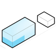
254% Potential
($45,505,492 Untapped Value)
Development Options for
135 Sanchez St, San Francisco, CA
What are the local zoning regulations for 135 Sanchez St ?
P (PUBLIC)
The main goal of designating land as a P District on the Zoning Map is to align it with actual land use and the General Plan. Such districts permit the occupation of lots by specified principal uses or conditional uses, respectively, while disallowing any principal uses not identified in these sections.
What is the maximum height for 135 Sanchez St ?
40-X
No portion of a dwelling can exceed a height of 40 feet, except that the permitted height has to be reduced to 35 feet where the average ground elevation at the rear line of the lot is lower by 20 or more feet than at the front line. The height is measured by taking a point at the centerline of the building or, where the building steps in relation to a street that is the basis for height measurement. Separate points need to be taken at the centerline of each building step. The upper point is the highest point on the finished roof in the case of a flat roof, and the average height of the rise in the case of a pitched or stepped roof.
What are the ADU regulations for 135 Sanchez St ?
ADU eligible
Accessory Dwelling Units (ADUs), also called secondary units, in-law units, or cottages, are units added to existing and new residential buildings. Adding an ADU to your property can provide several benefits, such as providing housing for family members, simplifying your lifestyle, and increased financial flexibility.Learn more about building ADU in this article
What neighborhood is 135 Sanchez St located in?
Duboce Triangle, San Francisco
The Duboce Triangle is a neighborhood of San Francisco, California, located below Buena Vista Park and between the neighborhoods of the Castro/Eureka Valley, the Mission District, and the Lower Haight.
According to the 2010 neighborhoods map of the San Francisco Association of Realtors (SFAR), Duboce Triangle is bordered by Market Street on its southeastern side, by Castro Street to the West and by Duboce Avenue to the North.[2] A 2006 definition by the city mayor's Office of Neighborhood Services puts the neighborhood's northern boundary further north at Waller Street (thereby including Duboce Park), while still excluding the San Francisco Mint building near Market Street.