Development Opportunity for
195 Beale St, San Francisco, CA
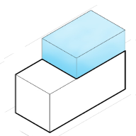
166% Potential
($611,362,800 Untapped Value)
This property is a Other currently used as a Commercial. Property is on a lot of 28,969 sqft and has a conditioned area of 764,661 sqft.
Development Options for
195 Beale St, San Francisco, CA


What are the local zoning regulations for 195 Beale St ?
TB DTR (TRANSBAY DOWNTOWN RESIDENTIAL)
The Transbay Downtown Residential District, which is wholly within the Transbay Redevelopment Project Area, comprises mostly publicly owned parcels containing infrastructure or underutilized land related to the Transbay Terminal and former Embarcadero Freeway. This district generally extends along the north side of Folsom Street from Spear to Essex Streets, and between Main and Beale Streets to the north side of Howard Street. Laid out in the Transbay Redevelopment Plan and its companion documents, including the Design for the Development and the Development Controls and Design Guidelines for the Transbay Redevelopment Project, is the comprehensive vision for this underutilized area as a high-density, predominantly residential, district within walking distance of the downtown core, transit facilities, and the waterfront. The plan for the district includes: a mix of widely-spaced high-rises, mixed with a street-defining base of low- and mid-rise buildings with ground floor townhouses; a public open space on part of the block bounded by Folsom, Beale, Howard, and Main Streets; ground-floor retail along Folsom Street; and several new alleyways to break up the size of the blocks.
The main goal of the Transbay Downtown Residential District is to transform publicly owned and underutilized parcels, particularly around the Transbay Terminal and former Embarcadero Freeway, into a high-density, predominantly residential area. Laid out in the Transbay Redevelopment Plan, the vision includes a mix of high-rises, low- to mid-rise buildings with ground floor townhouses, public open spaces, ground-floor retail, and new alleyways for improved urban scale.
What is the maximum height for 195 Beale St ?
50/85/550-TB
Height of a dwelling cannot exceed a 550 feet. The podium of the building can be as high as 50 feet and tower up to 550 feet tall.
Building heights associated with bulk designation "TB" describe a range of building heights per block, with the largest number describing the maximum tower height per block, and the smallest number describing the lowest maximum building height per block.
How to measure height in San Francisco?
A point shall be taken at the centerline of the building or, where the building steps laterally in relation to a street that is the basis for height measurement, separate points shall be taken at the centerline of each building step. The upper point to which such measurement shall be taken shall be the highest point on the finished roof in the case of a flat roof, and the average height of the rise in the case of a pitched or stepped roof.
What are the ADU regulations for 195 Beale St ?
ADU eligible
Accessory Dwelling Units (ADUs), also called secondary units, in-law units, or cottages, are units added to existing and new residential buildings. Adding an ADU to your property can provide several benefits, such as providing housing for family members, simplifying your lifestyle, and increased financial flexibility.Learn more about building ADU in this article
What neighborhood is 195 Beale St located in?
Yerba Buena, San Francisco
Yerba Buena was the original name of the settlement that later became San Francisco, California. Located near the northeastern end of the San Francisco Peninsula, between the Presidio of San Francisco and the Mission San Francisco de Asís, it was originally intended as a trading post for ships visiting San Francisco Bay. The settlement was arranged in the Spanish style around a plaza that remains as the present day Portsmouth Square.