Development Opportunity for
376 Castro St, San Francisco, CA
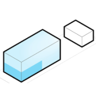
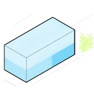
970% Potential
($36,686,463 Untapped Value)
This property is a Other currently used as a Commercial. Property is on a lot of 9,748 sqft and has a conditioned area of 1 sqft.
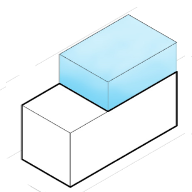
Development Options for
376 Castro St, San Francisco, CA
What are the local zoning regulations for 376 Castro St ?
NCT-UPPER MARKET (UPPER MARKET NEIGHBORHOOD COMMERCIAL TRANSIT)
The Upper Market Street Neighborhood Commercial Transit District is located on Market Street from Church to Noe Streets, and on side streets off Market.
Housing density is limited not by lot area, but by the regulations on the built envelope of buildings, including height, bulk, setbacks, and lot coverage, and standards for Residential Uses, including open space and exposure, and urban design guidelines. Residential parking is not required and generally limited. Commercial establishments are discouraged or prohibited from building accessory off-street parking in order to preserve the pedestrian-oriented character of the district and prevent attracting auto traffic. There are prohibitions on access (i.e. driveways, garage entries) to off-street parking and loading on Market and Church Streets to preserve and enhance the pedestrian-oriented character and transit function.
Housing development in new buildings is encouraged above the Second Story. Existing upper-story Residential Units are protected by limitations on demolitions and upper-story conversions.
The Upper Market Street Neighborhood Commercial Transit District, spanning Market Street from Church to Noe Streets and adjacent side streets, functions as a multi-purpose commercial area serving both local neighborhoods and a broader trade region. Well-connected by transit, including the Market Street subway and historic streetcar line, the district emphasizes pedestrian orientation. The controls aim to promote moderate-scale development, preserve the district's character, and maintain a balanced mix of commercial uses. Housing development is encouraged above the second story, with protections for existing residential units. Accessory Dwelling Units are permitted within the district.
Permitted Residential Uses: ADU, dwelling units, group housing and senior housing and homeless shelters.
Permitted Non-Residential Uses: Walk-up facility, agriculture (neighborhood), arts activities, entertainment (general), movie theater, child care facility, community facility, public facilities, residential care facility, social service or philanthropic facility, adult sex venue, animal hospital, gym, massage establishment, massage, foot/chair, restaurant, restaurant (limited), services (health), retail professional services and trade shop.
What is the maximum height for 376 Castro St ?
65-B
How to measure height in San Francisco?
A point shall be taken at the centerline of the building or, where the building steps laterally in relation to a street that is the basis for height measurement, separate points shall be taken at the centerline of each building step. The upper point to which such measurement shall be taken shall be the highest point on the finished roof in the case of a flat roof, and the average height of the rise in the case of a pitched or stepped roof.
What are the ADU regulations for 376 Castro St ?
ADU eligible
Accessory Dwelling Units (ADUs), also called secondary units, in-law units, or cottages, are units added to existing and new residential buildings. Adding an ADU to your property can provide several benefits, such as providing housing for family members, simplifying your lifestyle, and increased financial flexibility.Learn more about building ADU in this article
What neighborhood is 376 Castro St located in?
Corona Heights, San Francisco
Corona Heights is a neighborhood in San Francisco, California, just north of Market Street and Eureka Valley. Corona Heights is often considered part of the Castro and Upper Market areas.
In 1899, excavation began on the hill to make way for the Gray Brothers Quarry and brick factory. The quarry had removed tons of rock and produced tens of thousands of bricks, creating a blasted landscape.
George and Harry Gray (the Gray brothers) owned a total of three quarries in San Francisco. Besides The Corona Heights Quarry, One was located on Telegraph Hill, and the third at Thirtieth and Castro (now called Billy Goat Hill) located above Noe Valley.