Development Opportunity for
430 Portola Dr, San Francisco, CA
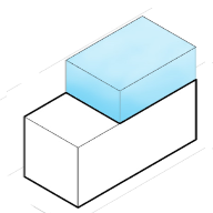
Amazing Potential
This property is a Other currently used as a Other. Property is on a lot of 126,794 sqft
Development Options for
430 Portola Dr, San Francisco, CA


What are the local zoning regulations for 430 Portola Dr ?
P (PUBLIC)
The main goal of designating land as a P District on the Zoning Map is to align it with actual land use and the General Plan. Such districts permit the occupation of lots by specified principal uses or conditional uses, respectively, while disallowing any principal uses not identified in these sections.
What is the maximum height for 430 Portola Dr ?
OS
The height is measured by taking a point at the centerline of the building or, where the building steps in relation to a street that is the basis for height measurement. Separate points need to be taken at the centerline of each building step. The upper point is the highest point on the finished roof in the case of a flat roof, and the average height of the rise in the case of a pitched or stepped roof.
What are the ADU regulations for 430 Portola Dr ?
ADU eligible
Accessory Dwelling Units (ADUs), also called secondary units, in-law units, or cottages, are units added to existing and new residential buildings. Adding an ADU to your property can provide several benefits, such as providing housing for family members, simplifying your lifestyle, and increased financial flexibility.Learn more about building ADU in this article
What neighborhood is 430 Portola Dr located in?
Midtown Terrace, San Francisco
The neighborhood features mid-century modern homes arranged in rows on terraced streets, surrounded by greenbelts, forests, reservoirs, and open space.
The land occupied by Midtown Terrace (approximately 150 acres) was once part of Rancho San Miguel, a large 4,400-acre parcel originally granted in 1846 to Don Jose de Jesus Noe, the first mayor of Yerba Buena (the pre-cursor to San Francisco). The land then changed hands several times, with ownership eventually being acquired by Adolph Sutro, a prominent engineer and developer and San Francisco's mayor from 1894 to 1896. To transform its "bleak" appearance, Sutro had eucalyptus trees planted on a significant portion of his property, which eventually became Sutro Forest. After Sutro's death in 1898, family squabbles and legal battles ensued over the land. His heirs eventually sold the area to developers and the various West of Twin Peaks neighborhoods began to take shape, being built on the "City Beautiful" concept of landscaped residential parks featuring detached single family homes.